Water detection: Sustainable solution to counter drought and water shortage
The recurring fight against the dehydration of agricultural land as well as against field and forest fires affects the entire world. However, not only habitats are threatened by climate change, global warming and weather extremes such as dehydration and drought: Particularly dry areas, for example near the equator, dry periods and frequent and intense droughts weaken agriculture for several years. Harvest losses due to water shortage lead to famine. The crisis is exacerbated by the lack of clean drinking water.
Solutions to counter water shortage, drought and dehydration
Supplying the affected regions with food and drinking water offers only a short-term solution, which unfortunately cannot reach all affected people. A more sustainable solution could be the support of agriculture and well building: The water detectors GeoSeeker and GeoSeeker Mini allow well builders, construction companies and non-governmental organizations to locate water resources up to 250 m deep, such as groundwater and water-bearing gravel layers. The data measured by the water detector provide an ideal basis for drilling wells. This means that drinking water can also be extracted in dry regions to supply agricultural land such as grain fields and fruit-growing areas with water.
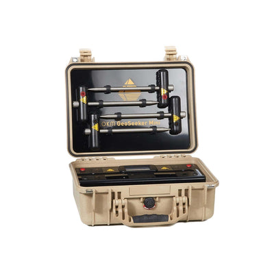
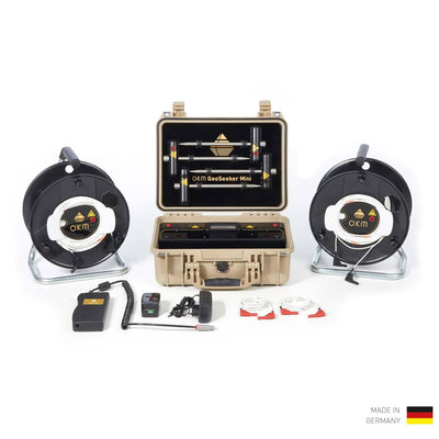
Advantages of using the water finder GeoSeeker Mini
Due to the number of measuring points, the waterfinder GeoSeeker Mini is suitable for a quick search for water resources. The GeoSeeker Mini is language-independent and can be used by inexperienced users thanks to the display of step-by-step instructions and results in simple images and pictograms.
Improved visualization of measurement data of water resources and cavities
Selection of display type
After the geoelectric measurement with the waterfinder GeoSeeker Mini, the data is processed. The type of display can thereafter be selected:- Water: The left button (water drops) leads to the simple representation of water finds. This shows the size and position of potential occurrences of groundwater or water-bearing soil layers relative to the measured field.
- Cavity: The middle button (tunnel entrance) leads to the simple representation of cavities. This shows the size and position of underground caves, tunnels and passages relative to the measured field.
- 2D diagram: The right button (diagram) leads to the scientific indication of all measured data. This shows the occurrence of underground water and/or cavities in the measured field.

If the buttons for water and/or cavity are inactive (light grey), nothing relevant could be detected. In any case, the scientific representation is available to give an overview of all geoelectrical measurement data of the current measurement with the GeoSeeker Mini.
Scientific representation with legend
Previously, the display showed a multicolored 2D diagram, which often required a second reading in the manual for exact evaluation - especially for inexperienced users.


Depending on the selection of the size and depth of the measurement, the display contains several columns and is provided with corresponding depth information.
Simple representation with pictures and pictograms
Using the left button (water drops) and the middle button (tunnel entrance), you can display simplified representations of the measurement results. Additionally, you can switch between the representations.


Advantages of GeoSeeker Mini at a glance
- simple operation via touchscreen with step-by-step instructions
- simple visual language: can be used by inexperienced users and in all languages
- detects water deposits and cavities up to 100 meters (328 ft) deep
- detects underground groundwater levels, fresh water, drinking water, water veins, watercourses and springs
- detects caves, tunnels, galleries and shafts, chambers and cellars
- supports well builders, drilling companies, agriculture, construction companies, aid organisations and military service providers, but also archaeologists, historians, treasure hunters and subsoil surveyors
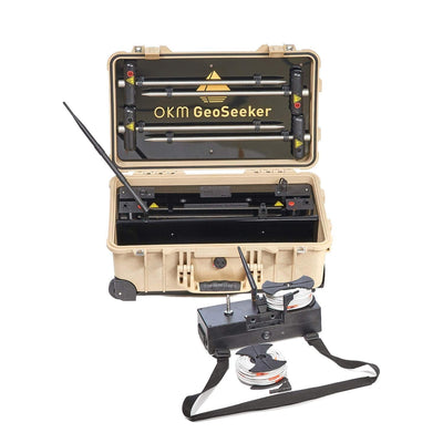
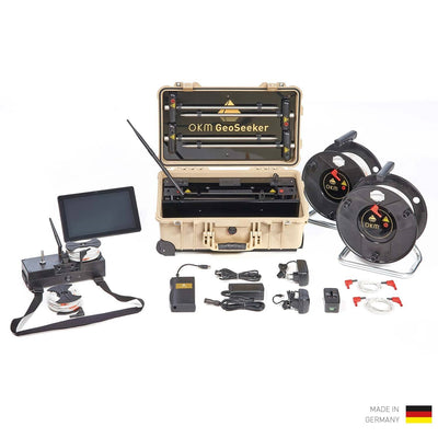
For measurements at depths up to 250 meters (820 ft), consider our more powerful geoelectric water detector GeoSeeker.
OKM water detectors in comparison: GeoSeeker Mini vs. GeoSeeker
OKM GeoSeeker Mini
OKM GeoSeeker Mini
Water Detector for depths down to 100 m (328 ft)| Max. measuring depth: 100 m (328 ft) |
| Total weight: 14 kg |
| Data visualization: 2D diagram / simple representation |
| Display / Operation: Integrated touchscreen |
| Operation time: approx. 8 h |
| Storage capacity: 4 measurements |
OKM GeoSeeker
OKM GeoSeeker
Water Detector down to 250m (820 ft)| Max. measuring depth: 250 m (820 ft) |
| Total weight: 35 kg |
| Data visualization: 3D diagram |
| Display / Operation: Android tablet PC (WiFi) |
| Operation time: approx. 16 h |
| Storage capacity: Unlimited, dependent on Android device |
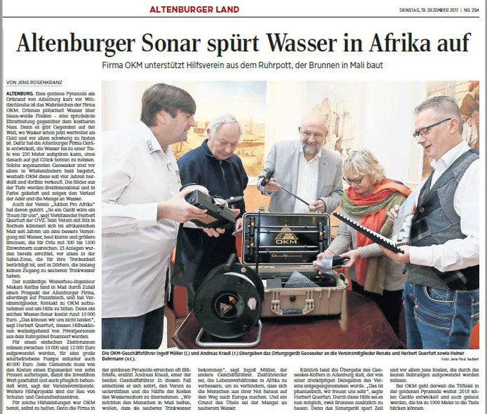
Handover of Water Detector GeoSeeker to "Aktion Pro Afrika"
Report of the Leipziger Volkszeitung (LVZ) on the support of "Aktion Pro Afrika" by OKM
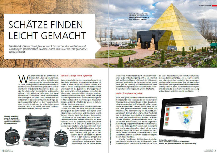
Report about OKM water detector GeoSeeker in POWER magazine
POWER, the HELUKABEL Group customer magazine, reports about OKM in Altenburg, Germany, and focuses on the geophysical water detector GeoSeeker, ...

Quick Scan Check: Vertical Blue Signals in OKM GeoSeeker Scan Image
A customer searching for groundwater sent in GeoSeeker scan images. The vertically distributed blue signals suggest surface water from irrigation ...